It’s funny how Mt Parnon is my home mountain, but I didn’t bother to prepare an article about it until now. It’s like posting pictures of your house on instagram stories: (apart from the obvious security risk) you see it every day, it’s not new to you anymore. However, owing to set of huge energy projects (follow SaveParnonas to stay up to date) that are being planned inside (?) the forest zone, I thought it would be better to document the mountain’s current condition. Just in case.

The Parnon mountain range lies between the prefectures of Arcadia and Lakonia, serving as a natural border between the two. Locals often refer to the mountain as Malevos, while the monastery situated at its heart is known as Panagia of Malevi. The monastery was originally founded in the year 717 at a remote site called “Kanalous” to protect it from thieves. However, an exceptionally harsh winter led to the starvation of the monks residing there. The last monk, before succumbing to hunger, reportedly wrote, “I am dying amidst the sound of the pines.” Legend has it that the holy icon of the Virgin Mary mysteriously disappeared three times, each time reappearing at a new location. Interpreting this as a divine sign, the locals eventually relocated the monastery to its current site. The mountain’s summit is marked by twin peaks, the Great and Lesser Tourla, which reach an elevation of 1,936 meters. On Parnon’s eastern flank lies another notable peak, Zavitsa, adding to the region’s striking topography.


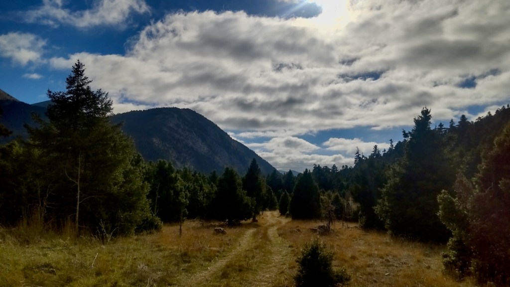
Parnonas features diverse terrain, including black pine, fir, cedar, and chestnut forests, which extend up to the forest limit at about 1,750 meters. The region is also home to rare and endemic flora, that is why it is protected under the NATURA convention, including an area extending up until Cape Maleas. Specifically, the cedar forest that surrounds the monastery of Malevi is unique not only in Greece but also in the entire European reagion. It boasts gorges like Lepida and Loulouga, as well as waterfalls and caves, such as the Peleta Sinkhole, the deepest in mainland Greece with length 620meters, and the Propantes vertical cave.


Human presence on Parnonas dates back to the Neolithic period, with Mycenaean settlements established by the 16th century BCE. The region was contested between ancient Argos and Sparta, specifically for the agricultural value of the plains of Thyrea. According to Herodotus, the Spartans invaded the Thyrea plain, capturing the area. In response, the Argives dispatched an expeditionary force. Surprisingly, a full-scale battle was avoided when both armies agreed to settle the conflict through a duel of 300 elite hoplites from each side, with the victor claiming the region. Only three men survived the battle of the 600 champions: two Argives (Alcinor and Chromios) and one Spartan (Othryades). Believing they had won, the Argives left the battlefield to announce their victory in Argos. However, Othryades, though injured, remained on the battlefield and claimed victory by virtue of being the last standing hoplite. Later, Othryades reportedly committed suicide out of shame, because the surviving Argives outnumbered the Spartans, ruining their reputation as great warriors.


In Greek mythology, Parnonas was associated with the mountain god Pan and the huntress Atalanta, famed for her exploits in the Calydonian Boar hunt and participation in the Argonauts’ expedition. The natives of Mt Parnon followed a more rural and pagan lifestyle compared to the high-class Athenians, which influenced the selection of local gods. The wild dog was so revered that the people of northern Parnonas earned the name “Kynourians,” which loosely translates to “dog folk.” Several temples devoted to the Olympians used to adorn the mountain, with the Olympians being revered with local nicknames such as Skotitas Zeus, Apollon Tyritas and Knakeatis Artemis.


Slavic tribes, including the Miligi and Ezerites, settled in inaccessible parts of Mount Parnon in the 8th century. Their eventual assimilation left behind place names such as “Zavitsa” and “Meligou” near Agios Ioannis. During the Frankish rule in the 13th century, fortresses were built in Geraki and Xerokambi to consolidate control, but the wild tribe of Tsakonians resisted fiercely. In the 18th and early 19th centuries, Prastos flourished as the historical capital of Tsakonia. However, the village’s prominence declined after its destruction by Ibrahim Pasha during the Greek War of Independence. Similarly, Agios Petros and Agios Ioannis became thriving spiritual and economic hubs, hosting monasteries and important schools founded by benefactors like Dimitrios Karytsiotis. The region played a significant role in the Greek Revolution of 1821, with Agios Ioannis hosting the Revolutionary Government in 1822 and Astros hosting the Second National Assembly in 1823. Villages like Vervena and Doliana were sites of key Greek victories against Ottoman forces. By 1991, the population had declined significantly, reflecting the broader challenges faced by Greece’s mountainous areas.


On Parnonas’ southern side we find the villages of Vamvakou, Varvitsa and Karyes, which administratively belong to Sparta. There’s been a recent trend to resuscitate these shrinking villages, with the financial backing of one of Greece’s largest funding institute. Incentives are given to young families to de-urbanise in the area and try out an alternative way of life, hoping that this will save these villages from desolation. The recent popularity of mountain tourism plays a critical role in this endeavour. A lot of mountain paths are actively been maintained and marked, to invite eager hikers.


There are two refuges on the mountain, one open to the public administered by EOS Spartis and the other serving only for emergencies. Parnonas has surprisingly low light pollution levels, causing it to be an optimal choice for summer stargazing. Many amateur astronomer groups organise camping events here. Inside the refuge, you’ll find the best decoration in my opinion (albeit the opinion of a history nerd). Next to the fireplace there’s a sign explaining that ‘grilling in the fireplace is not allowed (except for Lakedaimonians)”. This is a jab to the Persian wars, when all greek cities accepted the call to arms to fend off the common enemy, except for Lakedaimonians (Spartans). But guess who owns the refuge now, hehe.


Here, I provide two common routes on the mountain, either from Malevi Monastery to Megali Tourla summit, or from Vamvakou village to the refuge. Be sure to read the articles about the nearby Lepida gorge or the villa of Herodes Atticus. You can read more hiking posts under the tag hiking. If you liked this article, share it with your friends. You can also follow this blog, and follow me on Instagram or Facebook, to never miss a post. Until next time!


Read more:

Hiking in Greece: Lepida Gorge
In Greece, there’s a saying that goes, ‘If I don’t praise my house, it will fall on my…
Keep reading
Hiking in Greece: Herode’s villa at Loukou and the ancient Thyrea
Approximately a 2-hours drive from Athens, lies the small town of Astros. It is a seaside resort, especially…
Keep reading
Ridomo gorge and the sloppy Mt Chalasmeno
By now, I think Parnon and Taygetus are the mountain ranges I’ve visited most. A true-born Peloponnesian maiden,…
Keep reading