
For the past few weeks, I’ve made it a ritual to dedicate each Sunday to the hiking gods. Recently, I stumbled upon a delightful bunch of hiking folk, and together, we embarked on a weekend full of amazing – yet blurry – memories. Join me as we venture to the ‘unwritten’ realms of the Agrafa mountains (did anyone write anything about this already? Fingers crossed I’m the trailblazer here).

Did you catch the pun? Well, if not, no worries – it’s all in the translation. Agrafa, in Greek, quite literally means ‘unwritten’. This wild mountain range on the border between Karditsa and Evritania prefectures got its name probably because of the remoteness and unfamiliarity of its rugged terrain. Some mistakenly attribute the name to the area’s defiance against Ottoman rule, but more plausible explanations point to its absence from historical tax records, owing to its sheer remoteness. Throughout history, from the Byzantine to the Ottoman era, the locals have been depicted as fiercely independent, akin to the indomitable Gaulish village of Asterix fame.


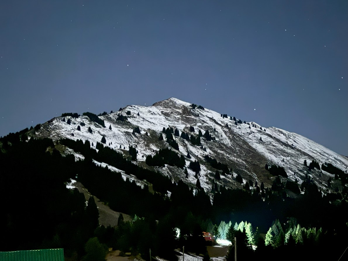
The Agrafa range is the southernmost bastion of the Pindus mountain range, the backbone of mainland Greece. The west side towards Karditsa is more easily accessible and developed, while the westernmost side is untouched, untamed and a climber’s paradise. The tallest peak in the eastern side is Karava at 2184m, while Delidimi at 2163 stands out in the west. There’s a local legend which claims that when God was creating the world, he sieved the dirt to construct the earth and its valleys. The thick lumps that remained formed the formidable massif of the Agrafa mountain range. The artificial lake Plastira is glorious in the backdrop. The area is hard to navigate and cross, due to the many deep gorges, which hinder the development of a convenient road network.

Due to its remoteness, the area was only sparsely inhabited throughout the centuries. During the ancient times the locals had strong ties to the oracle of Delphi, while later Vlachs and Sarakatsani nomadic populations migrated from the north and settled in the area. Over time, villages flourished, evident in the myriad of churches dotting the area. During the Ottoman era, rugged locals banded together to form groups of armed rangers, who played a major role during the Greek revolution. Later, at the end of the second world war, the village of Agrafa was burnt to the ground by the Italian occupation, with the exception of four buildings. It’s clear – life in Agrafa has never been for the faint of heart.

Our hike started at the picturesque village of Neochori, on the shores of lake Plastira, almost a 4 hours drive from Athens. From there, we followed a path full of lush, green trees to head towards the Agrafa mountain refuge. The path was easy and well-marked, with a smooth slope. We were prepared for a snow hike at the beginning of February, but mother nature disappointed us; winter never came this year. Thankfully, that turned out to be a fortunate circumstance, since my friend’s long unused hiking boots decided at that time that it was their time to die. Using the snow gaiters as an adhesive mechanism for her shoe soles, she managed to reach the refuge, so you can do it too! Now that the hard part is over, I can actually confess that there is a proper asphalt road available for those who are too lazy to hike up. It is this accessibility that makes the Agrafa refuge a hotspot for weary hikers and weekend travelers alike.


The refuge is actually comprised of two structures, the old hut and a newer one. The old hut is the meeting place and offers food and drinks, as well as beds, while the new hut provides solely accommodation. Apart from the staple spaghetti Bolognese, you can taste an excellent sweet potato soup. The owner, Vlassis, recommended their local tsipouro which is definately strong and probably the one to blame for my blurry memories. No snow meant an early arrival, which turned into early drinking, and finally an excited Elena almost dancing atop the tables.


The refuge has a direct view towards the Templa peak at 1808m. We didn’t attempt it at that time, but tried the easier Karamanoli peak at 1820m. I think what impressed me most was a half-house/half-farm structure in the middle of the path, which had an excellent view of both the lake and the west side of the mountains. The chap who owns it has the best of both worlds! Karamanoli peak is ugly in the sense that an antenna ruins the landscape, but it has an amazing unobstructed 360degree view, well worth it.


The residents of Agrafa tend to be extremely protective of their natural landscape, which gave rise to the #SaveAgrafa campaign against the installation of wind turbines at this pristine land. If you want to help raise awareness, you can buy T-shirts to support their cause at the refuge. You can spot them from the wolf logo.


On the way back, we headed down towards the village of Belokomiti. At certain spots on the path, I had a kind of a deja vu, since the terrain reminded me strongly of some mountains around Saitama prefecture in Japan. Curious games that the mind plays, right? Anyway, we had our lunch back at Neochori, at a restaurant named Kelepouris, which literally means a great catch, case in point. Just next door, you are going to find a building of an exceptional architectural beauty. It features a nowadays extinct style of a hanging wooden balcony. It is on sale, so you can consider this opportunity if you feel adventurous.


On the drive back to Athens, we were stalled by the recent demos of the farmers from Thessaly, who were marching with their tractors to the capital. In order to avoid the road blockage, we considered turning back and spending ‘involuntarily’ (#not) an extra night at the mountains. Unfortunately, the expressway was traffic-jammed albeit passable, hence our emergency vacation dreams were shattered.


If you’re interested in exploring the details of this hike, you can follow the routes here (Neochori->Refuge), here (Karamanoli Peak Loop) and here (Refuge->Belokomiti) on AllTrails. A couple of the photos were provided by Utopia Adventures and their friends (message me to tag you properly, if you see your photo in there). Be sure to check them out next time you are up for a hike or a mountain yoga excursion.
You can read more hiking posts under the tag hiking. If you liked this article, share it with your friends. You can also follow this blog, follow me on Instagram or Facebook, to never miss a post. Until next time!
Read more:

Hiking in Greece: The funnels of Mt Parnitha
The metropolis of Athens is surrounded by four mountains: Parnitha, Pentelicus, Hymettus, and Aigaleo. Out of these four,…
Keep reading
Day hike from Tokyo: Chisuji falls, Mt. Takanosu and Mt. Byobu
Hakone is one of the most visited places among people visiting Japan for the first time. Despite its…
Keep reading
Day Hike from Tokyo: Exploring Myojingatake and the Outer Caldera of Hakone
[Visited on September 26th, 2020] Since I recently moved to Kanagawa (again), it makes sense to focus more…
Keep reading